Feeds:
Posts
Comments

Archive for the ‘Uncategorized’ Category

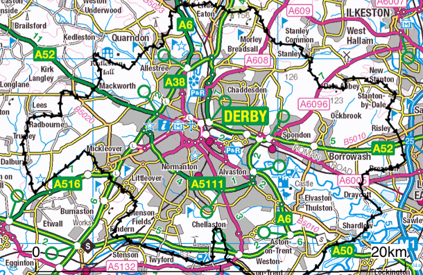
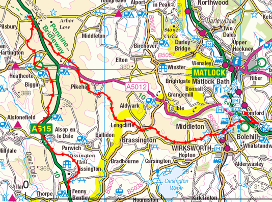
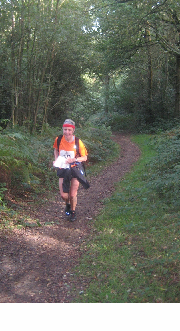
Dig Deep Races offer 4 different races out into the Peak, all starting from Whirlow Hall Farm on the western edge of Sheffield. I upgraded from the 30 mile ‘Intro Ultra’ to the 60 miler (different course) 3 weeks before the race, not knowing we’d get a heatwave!

Image

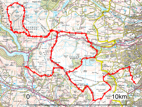
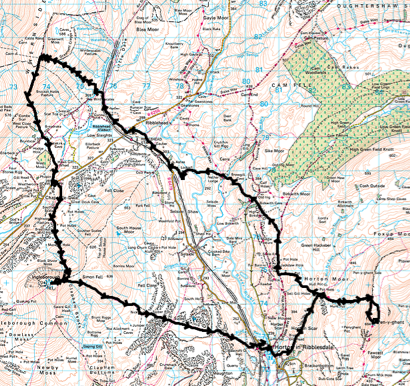
1st half of the UTPD – the 2nd half is Win Hill, Kinder and Hollins Cross, then back to the Start via Bradwell and Bamford

I quit at 31 miles but thought I’d write it up anyway as it’s a good challenge!

I drove up a few days before the race with Dave’s family to suss out where the farm was, as the race briefing was at 7:30 on the Sat morning, with the Start at 8. I had a 14 hour schedule – to get back just as it’s going dark!

They supply a 1:40000 map of the route which you can collect from Outside in Hathersage, and I’d also done 1:25000 sheets from Anquet. I registered and dropped off my 3 food parcels for 15 & 25 miles (Moscar – Parcel 1), Yorkshire Bridge (Parcel 2) and Bradwell Sports Club (Parcel 3 – unclaimed – they are welcome to my boiled egg, crisps and Red Bull).

At the briefing they told us they had 700 litres of water out on the course as it was one of the hottest days of the year! We set off at 8am at quite a pace. The route was marked to Checkpoint 1 at Fiddler’s Elbow (11km) where there was water. A short path section was marked after this but not to the road so I lost 5 mins and nearly went up Higger Tor!

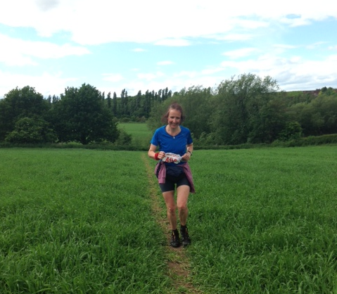
After that was a loop round Redmires and Rivelin Reservoirs and back west to Checkpoint 5 (and 8) at Moscar. I got there at 11:30, about 15 mins behind schedule and very sweaty! Dave met me there for the lasso bit around Lost Lad, which was 15km with quite a bit of climb – predicted and actual time 2h 30.

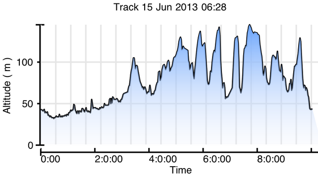
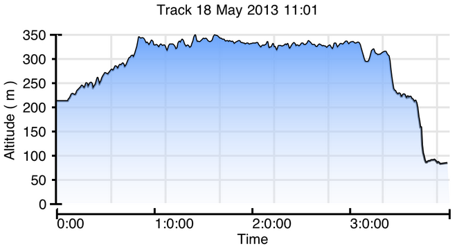
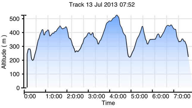
This was a lovely loop with checkpoints on Lost Lad and Ladybower, then a big climb up back to Derwent Edge (see dip at 5hrs on altitude graph!).
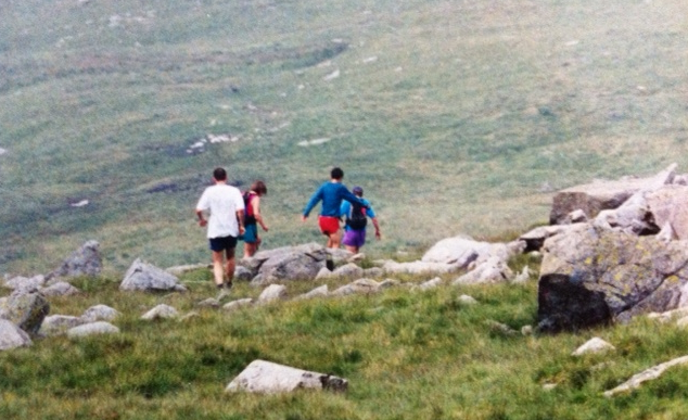
Image

Image

At Back Tor

Got back to feed box at Moscar at 1:45 and considered quitting then as I felt quite sick in the heat but I sat in a marshall’s chair and took on some food and decided to carry on until Yorkshire Bridge and then decide. Anyone planning to do this race should schedule in proper rest time as well as running time – I was there for 15 mins.

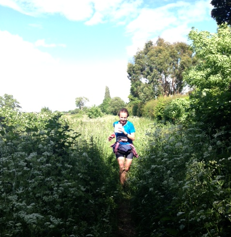
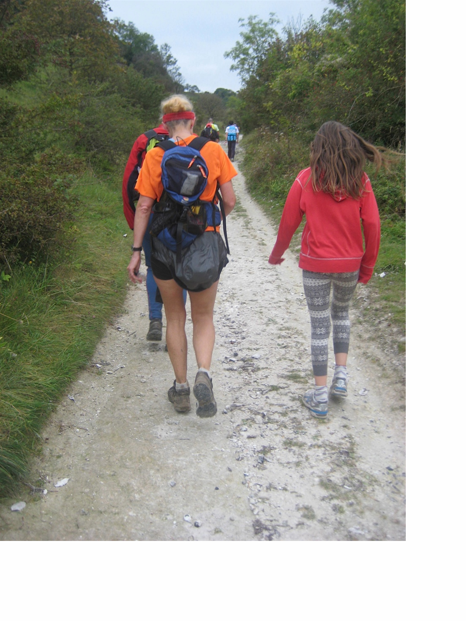
I set out with Dave over Stanage – another tip is to take a Buff to dunk in streams from time to time – I had to run with Dave’s T shirt under my headband!!

Image

Dave turned round to get the car and I continued to Yorkshire Bridge on the road below Bamford Moor. I was still running but the sight of Win Hill looming above me and the fact that I was 2hrs behind schedule (= midnight finish) made me decide to stop here.

Image
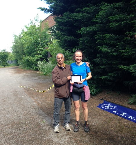
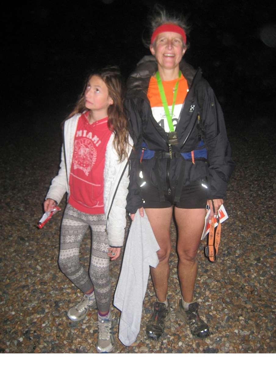
Grabbed a coffee from the flask and drove back to retrieve my car and report in as ‘Retired’ in Whirlow, where there was a welcome bowl of stew and a nice bench. Finishers in the 30 mile race were being clapped in in the next field but we were too gutted to go and watch. A marshall told me that the winning time for this was 1hr 30 slower than last year due to the heat.

I would recommend these races for the friendly atmosphere, great courses and helpful marshalls. The 60 miler is quite bitty with loops that make it more difficult to visualise progress than in a circular or A to B race. Reccying would definitely be helpful, as would a realistic schedule allowing rest time. As Dave says, unfinished business…

Read Full Post »

Long Eaton Ultra 2013

I did this 50-mile race in 2012 in 11 hours with quite a bit of reccying (see June 2012 post) and further reccying this year – so this post is mainly photos and stuff from my new ViewRanger tracking app on my i-phone.

ImageThe Start is at Breaston (far right, under black trace) and the route goes clockwise beginning with 15 miles on the canal tow-path. It’s so long that on the laminated safety card you get at the Start, there’s numbers for A&E in 3 different cities!!

It’s a very friendly race and you choose your own start time between 6 and 8am, with relay runners starting at 9am. CP1 (10.5 miles) is the dog-leg upto Chellaston and I got there in 1hr 34 for jelly babies and water. The canal is lovely at that time of morning and I saw 2 herons and other birds. Unfortunately I forgot you needed to cross to the north bank a-bridge-before leaving the canal as the final bridge is railway-only so I needed to back-track 300m! End of the flat….

Image

Despite the gentle start, there are 2916 ft of ascent on this run – the dreaded steps of Duffield are the vertical line at about 7 hours

Coming into Findern I was met by a man on a bike in a fluorescent jacket who was showing us how to get through a housing estate into a concealed jitty leading into the fields. From here to CP2 at Littleover is tough to navigate and to run as the grass is knee high and there are no paths.

Got to CP (18.5 miles) in just over 3 hours and texted home that I was ahead of schedule as I had a rendez-vous with my flask and family at CP3!

Leg 3 is the worse to navigate but there were written instructions available at each CP and I made sure I picked up a set in Littleover as there were some new directions about avoiding an electric fence in Dalbury. I’d reccy’d this section again in May and took a photo of the oil-seed rape – which by race day was head high!!

Image

Got to CP4 (28.5 miles) Bluebell Inn at Kirk Langley at 11:35 and was met by Dave and Zoe, with coffee but sadly lunch was still in the fridge at home. Dave was dispatched into the pub to buy crisps and peanuts and the man on the bike from Findern gave me a gel. (There was plenty of food at each CP but my milk and yeast intolerance excludes most of it.)

By now I was 30 mins ahead of my 10h 45 schedule and was beginning to think it would be good to come in under 10. There were 21 miles to go, and 4h 30 to do them in so it seemed possible. There were some heavy showers on the way to CP4 at Duffield and I got there at about 1:30. Those that wanted to left a box at the Start to be taken to this CP so I got mine, with food, water and the final stage map.

I met Dave at Morley so there are a lot of photos of the last 10 miles….

Image

Image

Dave says this video approaching Dale Abbey shows determination – which is another way of saying I look knackered!

Here’s another one but, beware of horizon shift…

Our stop at CP4 Carpenter’s Arms in Dale Abbey was quite short as I needed to do the last leg (5.25 miles) in under an hour to get a time of less than 10 hours. It’s a nice last leg though, and the route finding isn’t too taxing.

Image

Got a bit of a second wind with Dave setting the pace and soon arrived at the Finish in the car park opposite the Navigation Inn. Was met with a great welcome and camping chair and presented with a mug and the plaque for 1st lady.

Image

You also get a soup voucher for the Navigation Inn so it was nice to chat to other runners and I’m sure beer is a great isotonic fluid replacement!

Read Full Post »

Morecambe Bay Walk

Although this wasn’t a race, I thought I’d write it up as walking across quicksand for 9 miles still has a definite head-banging quality to it! We registered to do the walk as part of a sponsored event with the Queen’s Appointed Guide to the Sands, Mr Cedric Robinson MBE, to be sure of survival!

It’s not a circular walk so you need to arrange transport to get you back to your car at the end. The train, with the 1857 viaduct across the estuary, is a popular option (see photo), but we lined my dad up to give us a lift.

Image

We arrived at Arnside at noon to find it swamped with walkers, mainly queueing to use what toilet facilities the small village had to offer! We chose a nice bakery with coffee-to-go. I registered us and gave in our cheque to Galloway’s Society for the Blind and then, at 12:30, we were off.

lunch at Blackstone Point

There were over 200 of us and the pace was quite slow as we did the first couple of miles down the coast and through a wood. We had a quick lunch stop on the beach at Blackstone Point (photo above), then headed out across the sands proper. Here the pace quickened as we no longer had to follow the people immediately in front.


You could see the 2 rectangular blocks of the 1983 Heysham nuclear power station on the horizon shimmering in the (?!)heat haze (photo above). Although it was a sunny day with not much wind, I needed my waterproof top all the way, especially as I was wearing shorts. Some people took their shoes off for the sandy part of the walk and this was just about OK as sometimes it was hard sand and sometimes muddy. In some places we were wading in water well above the knees so that was another consideration!

We could see a large vehicle in the middle distance and the Galloway’s Guides seemed to be taking us towards it. This was where Cedric was meeting us to see us safely across the Kent Channel (outlet of the Rivers Kent and Gilpin). We’d had to check the Galloway’s facebook page on Friday to see the latest info for the crossing and were relieved to find that it had been safely marked! This was by laurel branches pushed into the sand that were visible for quite a distance and stayed put for about 3 weeks.

At about 3pm we got to the edge of the Kent Channel and the guides lined us up along one side so we could all cross together rather than in sequence. This was the highlight of the walk for the girls as it looked quite deep and fast!! The whistle blew and we were off. There were  screams as there were a few branches being swept down in the water – sharks!! –  and were where careful that everyone’s mobile was in the highest and driest pocket possible!Image

On the other side we met the huge tractor and grouped up for a photo (you can see us on the right)…

Image

After that we continued south for at least a mile before turning right and back towards the finish at Kents Bank Railway Station. So the Kent Channel on the GPS map is now actually further to the east and is where the GPS trace (red) intercepts the line of pink dots.

Image

We crossed a few other smaller channels before getting to the salt-marshy area next to Humphrey Head. This was grassy and pretty but quite smelly due to the sheep and we put our shoes back on here!!

Image

The last part of the walk had been quite long and tough after the excitement of crossing the Kent Channel and we were glad to get to the railway station and comfort of the car! We finished at 4:45 exactly as predicted, which is amazing with that many people. It had been a really good day and one of the strangest walks I’ve due to the fact that most of it was below sea level…

Image

Read Full Post »

The White Peak Marathon goes from Thorpe (near Ashbourne in Derbyshire) to Cromford along two former mining railways converted to cycle paths. You are taken by bus to Thorpe and start on the Tissington Trail, then at 11 miles after 160m of gentle climb you U-turn onto the High Peak Trail with a descent of 250m, mainly down the three ‘inclines’ after 22 miles. The ‘Altitude profile’ on ViewRanger on my i-phone shows this rather well!Image

I did the 2012 race in 3:56 and the only split I can remember is 21 miles at 3 hours. That the last 5.2 miles took 56 mins shows a dramatic slowing (from 8.57 minute miles to 10 minute miles) and I do remember walking 3 or 4 stretches. This year I was joined by my husband Dave on his 1st marathon. He’s often run the distance in fell races but never on the (relatively) level!

I went off faster and he caught me at 2 miles, I never lost sight of him and got a boost at about 9 miles and overtook. The trail meanders gently uphill and the mist was blowing into our faces. The psychological advantage of this was that you couldn’t see runners a mile ahead of you like you could last year. This is always a bit demoralising!Image

Running a marathon is all about fractions – soon you are at 6 miles, which is nearly a quarter, then 10 miles, then half way. A half marathon runs in parallel but starts at the same time as the full. I crossed the half marathon Start line at about 1:45 so was pretty pleased with that.

However at about 17 miles I began to feel my fingers going numb so I had my boiled eggs, a seed bar and dropped my glucose powder and Nuun (electrolyte) tablet into a cup of water at the next drinks station. Dave was carrying his Platypus but I didn’t carry a drink as there are 7 water stations, one of which you pass twice!

I felt a big improvement but Dave and many others were still passing me. I passed the 21 mile marker at 3hrs 2 mins, a bit slower than last year but still running and going particularly well down the inclines. The bit from Harborough Rocks is home territory but certain sections still drag!

I passed Dave on the final and longest incline and thought he would get me on the last ¾ mile section along the canal and although he didn’t, he was less than a minute behind. I was pleased with 3:54:14 – 2 mins faster than last year!

Matlock Athletics Club did a great job at organising a friendly race and a goody bag and mug at the end with a pun on ‘Swift Half’ and ‘Complete Satisfaction’!Image

Read Full Post »

I volunteered to coordinate the Middles on Stanton Moor about 18 months before the event and by then DVO had been negotiating with various landowners for 6 months, partly to try and include Hill Carr Wood in the competition area. DVO had hosted the 2011 CompassSport Cup Final at Longshaw and the Club gained a lot from the experience, including having the same Safety Officer for the Middles.

Hill Carr was not to be and by 12 months before the event, John Duckworth (the Planner) and I had identified the Assembly and ‘final’ parking. Something to work with in conversations with DVO Team Leaders, British Orienteering, English Heritage and local groups. The coordinator’s role is really to keep track of what’s happening as briefed by Team Leaders!

My husband Dave was Assistant Coordinator and we competed in the 2012 Sprint and Middles, both hosted by EBOR, to get a feel for the size of the event and pick up some tips.

I met the Sprints team at the BO Event Officials Conference in September and this was useful as we had to liaise over equipment and bibs etc. The Conference also made me think about what makes for a user-friendly event. It was around this time that fees were agreed and entries went live on Fabian – a major milestone!

The track to Assembly in early April. Competitors' cars were parking elsewhere, but traders vans, Portaloos, commentary and officials' cars needed to drive through here

The track to Assembly in early April. Competitors’ cars were parking elsewhere, but traders vans, Portaloos, commentary and officials’ cars needed to drive through here

The 8 months of rain followed by 2 months of snow meant that we ‘lost’ the parking field in January and made other arrangements for parking and bussing. The BO mini-site was a great tool for letting people know about this. Then, on the Wednesday before the event, the farmer phoned and said we could use the original field – so yet more changes but well worth it! I dread to think of the chaos this would have caused in the days before email.

Time definitely passes quicker on the weekend of the event. A dozen club members made-ready the Assembly area on the Saturday, catching occasional glimpses of John and Tony Carlyle (Controller, AIRE) disappearing into the forest. And at 7:15 on Sunday the traders began to arrive, followed quickly by competitors.

A lot of thought had gone into the arena start and the requirements for running a timed start while accommodating EOD runners. On the day, everything went very smoothly and I know that John and Tony were as relieved as I was when the first finishers came through. There were 1105 runners across the 13 courses, with anticipation building as the Open classes started in the second half of the start window.

It was great to finally relax chat with old friends at the event – as well as to my brother who had driven over from the Lake District to ferry equipment in his van. There were a couple of issues to talk through with the Controller and it was great to have someone as experienced as Tony to advise me. Soon it was time to set up for the Prize Giving and again DVO helpers (see photo) and the commentary team did a great job.

Just some of the 96 DVO members who helped on the day and before

Just some of the 96 DVO members who helped on the day and before

It was amazing how quickly everything was dismantled and put away before the first drops of rain. I really enjoyed working with everyone to put on a successful and safe event that finally came into being after so much emailing! I also got a good insight into the usefulness of the Rules, which I’d not really considered much in 25 years of orienteering!

(This was written for Orienteering Focus shortly after the event.)

Read Full Post »

Yorkshire 3 Peaks Race

I’m not sure if I should write a post for a race in which I was nearly last, but felt the start of a new season should be marked! My husband Dave had made a note of the date when entries open for this classic 23-mile fell race as we’d missed it last year and there are ‘only’ 900 or so places.

We travelled upto Malham Youth Hostel the night before and arrived at Registration in Horton-in-Ribblesdale with plenty of time. Dave was hoping his knee would hold up after a bad fall 7 weeks ago so we’d planned to set off together – but then he failed to find me in the Start pen.

3P map

Route trace on my new ViewRanger app (the Start is at Horton on the very bottom, then anticlockwise to Pen-Y-Ghent with Whernside at the top and back via Ingleborough)

The Three Peaks are Pen-Y-Ghent, Whernside and Ingleborough and it’s a classic walking route that takes about 11 hours. Running, the first split is from Horton to Pen-Y-Ghent summit (694m), a distance of 5.5km. The event has an excellent website with last year’s results and split times.

We’d chosen a 2012 finisher who ran 4 hours 40 mins and used her splits – and I was relieved to find I was on course, taking 47 mins! Mind you, the pace was quite brutal so I was among the first to start walking!!

One of the reasons we used previous split times is that there are 2 cut-off points round the course, and if you don’t get there within a certain time you’ll not be allowed to continue. We knew the cut-offs would be quite tight – the first is at the Ribblehead Viaduct 18km into the race at 2 hrs 10 mins, and the 2nd is at the Hill Inn in Chapel le Dale at 3 hrs 30 mins.

The going was quite fast descending Pen-Y-Ghent as a lot of new paths have been made to prevent erosion. Flint chippings have been used and they are quite nice to run on as there’s that bit of bounce – unlike the older flagstone paths and steps elsewhere in the race.

I got to the Ribblehead checkpoint in 2 hrs 26 seconds and was cheered on by my brother. We had deposited 2 drinks at the Start and I collected one of them here as I’d decided not to carry any water with me – something of a mistake as this race is notorious for cramp!.

The next hill, Whernside (736m) was extremely steep as we went up the front rather than the ridge. People were using their hands in places! I got severe cramp in my right calf and had to stop while it subsided. I carried on, scoffing a bar to try and replace electrolytes and it helped a bit. One of the marshals had a really booming voice and he kept telling us it wasn’t far to the top.

The race elevation profile from my new ViewRanger app

The race elevation profile from ViewRanger

It took me 59 mins to get up Whernside (central peak on graph!) and I knew I’d have to leg it to be inside the cut-off at the Hill Inn. I filled my water bottle from a semi-stagnant puddle and had a welcome drink. Walkers and marshals were very encouraging but kept telling us to hurry up to make the cut-off. My brother met me on his bike about 200m before the checkpoint so that was a good boost and although my time there was 3 hrs 30 mins and 44 seconds, they kept it open for another minute or so before asking people to retire. I later overheard one runner telling another that last year he’d come back on the ‘bus of shame’!

The last section was only 11km so even though I was tired, I knew I could do it. John told me that Dave was 10 minutes ahead of me so I was pleased that his knee had held out. I collected my 2nd water bottle and swigged the contents before the final haul up Ingleborogh (724m), which took 55 mins.

3Psal at finish

At the finish of the Yorkshire 3 Peaks Race
Photo: John Brockbank

It was a long but nice descent through the limestone plateaux but finally I saw the marquee in Horton and squeezed out an extra sprint, finishing 616th in a time of 5 hrs 16 mins. Dave and John were waiting for me at the finish line and I must have looked tired as I had to fend off the attentions of an aged St John Ambulance volunteer! Dave had finished in 5 hrs 2 mins which is pretty good after 7 weeks of no training and we are now looking forward to the White Peak Marathon in 3 weeks!

Dave at finish of Y3P Photo: J Brockbank

Dave at finish of Y3P
Photo: J Brockbank

Read Full Post »

What is the Bob Graham Round?

(I didn’t have the blog when I did this 24 hour challenge in 1999, but I thought it would be a good additional post!) The route was first done in 1932 by (yes, you’ve guessed it, Bob Graham) and involves 42 Lake District peaks, 72 miles and 26,000 feet of ascent in under 24 hours. If you think about it, this means an average speed of just over three miles an hour, so you tend to walk the uphills and run the downs and the flats. It wasn’t repeated until 1960, but since then over 1700 people have done it.

Preparation

Over the previous year I had built up to running/walking 45 miles (i.e. being on my feet for 10-15 hours) and had reccied all of the route at least twice, using my Dad’s house in Windermere as a base — and calling on his babysitting abilities while Dave ferried me to distant start points and accompanied me on runs (or more often went gear shopping in Keswick!).

Organisation

The route is divided into five sections where it crosses roads (HonisterPass, Wasdale Head, Dunmail Raise and Threlkeld) and at each of these points a different pair of ‘pacers’ take over to carry your food, fine tune the navigation and record your time on each summit. I’m lucky that my brother — who has done the BG in both summer and winter (fool) — could organise much of this, although John Duckworth and some other Derbyshire folks accompanied me on my first attempt and Dave Clough saw me briefly (!) on the second one.

You can run either clockwise or anticlockwise and it’s best to set your start time so that you do the grassy Helvellyn ridge in the dark — this means a morning start going anticlockwise or an evening one if going clockwise, although having said that, a lot of people start at midnight and do Skiddaw in the dark.


Attempt 1: Clockwise, May 28th

I shouldn’t really have started this as the weather was so foul and, sure enough, we lost a lot of time at night to atrocious visibility. I didn’t have the energy to start running again once the dawn broke, but I carried on a bit, hoping for a second wind. It never came, so we packed in at Rossett Pike, about half way round, and took the low route on to Wasdale. I don’t know if I’d have got round then, even in good weather, as I was recovering from a cold, had only trained to 30 miles, and felt pretty bad for missing a night’s sleep so early on in the run … a new strategy was required — an anticlockwise attempt.

Attempt 2: Anticlockwise, July 10th

A walking holiday in Ireland plus doing the Saunders Lakeland Mountain Marathon with Dave got me in good shape for this. You have to do a write up for your run to count officially, so here it is.

I opened the curtains on Saturday morning gutted to see mist of the consistency that had thwarted my previous BG attempt six weeks ago, and even considered postponing things on the drive to Keswick. Good thing husband/road manager Dave talked me out of it! Joined pacers Tony Walker and George Robertson at the Moot Hall and set off at 7.30 Imagethrough the mizzle to Low High Snab, reaching the summit of Robinson in 90 mins. The mist was thinner on the tops, so navigation wasn’t a problem (yet!). One of the main roles for pacers on this section is to slow you down, but I’m glad Tony and George didn’t do this.

At Honister, Mark Flemming and dog Maggie took over. After Mark’s canny route off Great Gable, where I was thoroughly disoriented, we were on schedule to Pillar but started looking for Steeple too early — before hitting the wall on Scoat Fell — so lost 15 mins, but apart from that, Maggie had a pretty good nose for the path when she wasn’t too busy chasing her tail! Was cheered to see Hilda on her clockwise BG at Steeple and still on schedule. Good scree run off Yewbarrow — better than stumbling through bracken covered boulder fields, as on my previous recce.

At Wasdale was met by Dave Clough from our orienteering club who’d walked over from Honister having just missed me. Had some of Kate’s chicken stew and a Dioralyte to rehydrate, plus mandatory tea and Isostar. Seeing Fred Rogerson there made the BG attempt somehow seem more real.

Then new pacers Brian and Susan Clough for the Big Bad Central Section. On the way up Sea Fell took an impromptu decision to descend via Lord’s Rake rather than Fox’s Tarn and this saved a lot of time as it was only 31 mins summit-to-summit. Saw some of the Wasdale racers on Sea Fell Pike — great atmosphere up there; the pacers seem to know everyone we pass, like it’s their local high street. Brian and Susan had some canny routes and a seemingly endless supply of jelly babies, which saw me through my only bad patch. I remember saying to Brian when we were descending Bowfell that Rossett looked like the Eiger, but we were there in a jiffy, having coffee and Battenburg with Munro Bagging chums Sue, John and Martin. They said they’d seen me looking worse, but only after a night in the pub! The mist had cleared now and John Cann joined us to Dunmail, where he arrived in his white T-shirt, looking more like a Persil advert than a fell runner!Image

The crowd put on a great welcome and I had some more stew and Dioralyte by the dual carriageway. The last three sections had taken 12 hours 50 mins, exactly to schedule.

ImageIt was a good feeling setting off up Raise Beck with BG guru Eric Draper and husband Dave, knowing that I had 11 hours to get back to Keswick and plenty of daylight to get off Fairfield. Eric found the gully down and we were soon zigzagging up Dollywaggon. Helvellyn was reached, 30 minutes up on the schedule. The wind was starting to pick up now but there was no mist and the grassy whalebacks of the Dodds were soon traversed. However, the 30 minutes were soon lost in the farmland at the bottom of Clough Head where we plodded through endless tussock of reeds with a few stone walls for good measure. Boy, was I relieved when I heard Eric say he was on the road.

Met brother and BG veteran John Brockbank at Threlkeld where I scoffed some egg butties and set off up Halls Fell Ridge, Eric continuing on this section too. Torches off at the top and jogged down Mungrisdale Common to a technicolour dawn (which, having caught on camera, John proceeded to fall into a bog and submerge said camera), Imageand ice-cold Caldew and that endless fence up Calva. I was slowing on this last section, and it was a good job it wasn’t any longer or I wouldn’t have made it. On the top of Skiddaw we met Dave in an icy wind and jogged down to crystal clear views of the whole of the Lake District rippling out in front of us. Met Caroline and Kate (Eric and John’s partners) on the way into Keswick and arrived — incredibly happy — at the Moot Hall at 7.03 where there were hugs and Bucks Fizz.Image

ImageThanks go to all the pacers for their excellent company (and those that paced six weeks previously); to training partners in Derbyshire and the Lakes; to John for inspiring me, showing me the routes and rallying the support for both attempts; to Dave for believing that I could do it, not letting me give up when winter training was getting me down (this tended to involve taking me to the pub) and miles of driving over Lakeland passes; and to my Dad and Dave’s family who spent many a weekend looking after Zoe while “Mummy ran up the mountains”.

Read Full Post »

chips

The night before and chips for all the family – honest!!

After over a year of anticipation, the day finally dawned – although I should say the alarm went off at 4:30am, 2 hours before dawn! Registration at the TA Centre in Blackheath closed at 5:30 and I had a DIY breakfast of potato farls in the hotel room (ever smuggled a toaster into a Hilton before?).

Dave drove me there and waited to see me start. There was quite a buzz about the place and good facilities. They do a bag transfer to the Finish, but we didn’t use it. Dave picked up his own Route Book, which was handier than the photocopies I’d made. Road support is quite tricky when you don’t know the area and have children who won’t navigate for you!

I later learnt that there were 196 of us at the Start and I soon found myself at the back of the leading pack of 5, bearing left down hill across the grass. The bit through Lewisham and Catford is fiddly – through a mixture of back streets and urban parks. A torch was necessary for the first half hour or so.

start

6am start at Blackheath TA Centre

There’s an unlikely bit where you go through a retail park after Catford Station, then you run alongside the Pool River to the first hill at Bellingham. People were starting to overtake me here and I made an error coming out of a wood on the golf course which meant I ran extra distance round a field.

I got to Bromley Station at about 6:55, you then stay on a B road for 5 km to the first checkpoint at Keston. I arrived there at 7:38, 3 mins behind my 12hr schedule time but still pleased. There was plenty of water so I filled my empty bottle (hadn’t carried any for the first 10 miles to save weight) but only bananas so I had some food I’d carried.

Suddenly the route is in the countryside and the navigation is very tricky. I lead whatever pack I was now with to Furze Bottom, from which you can see a column of runners walking up towards Biggin Hill RAF Station.

After that it’s up the nose of Biggin Hill itself and over some flinty ploughed field to Tatsfield, where there’s a nice village green for supporters to hang out – but mine were still emerging from the hotel!

A kilometre later was the first of the day’s permitted detours across private land. These two places are the only bits where the route is signed. A stile had apparently been put up across a barbed wire fence but had been removed so we climbed over some wobbly tree branches.

limpsfield chart

9:20am – up the hill to Limpsfield Chart at about 18 miles

After that you cross a bridge over the M25 just west of Clacket Wood Services and climb up to another nice village, Limpsfield Chart. Dave and the girls met me here at about 9:30. Had some food and water but didn’t hang around for the coffee. This race is so long that every minute counts! The organisers even warn you not to start walking just coming up to any stiles!!

Had a navigational wobble and went wrong way to Checkpoint 2 but only minimal extra distance but 5 mins hesitation error. Got to checkpoint at 9:40, 25 mins behind 12 hour schedule, which was worrying but I was running well and not feeling too tired. They had the legendary cold roast potatoes here and they went down very well!

3km along farm tracks then you cross Edenbridge Golf Course then some paths on the Eden Valley Walk where you need a compass. Dave met me just east of Dormansland and did 4 miles with me, which he then had to reverse to get back to the car! The route is hilly but very pretty as you approach Checkpoint 3 at 28 miles. Got there at 11:35, again 25 mins behind schedule, but no increase in slippage time which was good.

Coming into Ashurst Wood, I’d got lost on my reckie and still did it sub-optimally – but at least I didn’t have to resort to navigating with my i-phone! You then go east round Weir Wood Reservoir on more farm tracks and up into Lavender Platt wood where there’s a car park where spectators can meet you. Mine missed me, but everyone else’s supporters give you a good cheer! Then it was a nice run into Checkpoint 4 at Horsted Keynes past some very secluded farms and forestry.

Picked up a phone call while having some potatoes and biscuits at the checkpoint and met Dave 2km after. Then saw him again at Freshfield before he went to park at Chailey Common and came out with our youngest to run with me while the eldest got the coffee ready! (Wow, did I really run 34 miles before I got my coffee??)

Exiting Pound Common I went the wrong side of a farmhouse and had to run 3 sides of a square and cross 2 barbed wire fences in thorns. After this I can’t remember much until Checkpoint 5 at Chiltington, 48 miles, where I arrived at exactly 4pm.

black cap better

Walking up Black Cap with the family

That the 10 mile section to the Finish took 3 hours 7 mins shows how slowly I was going, but I was still running. There’s about 1000 ft of climb over the South Downs and Dave and the girls did the main ascent up Black Cap with me. On this section you are on walkers’ footpaths so the navigation is easy.

You take a bridge over the A27 at Falmer and go parallel with the very fast Falmer Road but in the fields, just on the verge for about 300m. Then you run along the seemingly endless north edge of Woodingdean and turn south onto Brighton Race Course which is very nice running with great views. It was dark by now and I had a black cagoule on so although Dave had reversed the route from the Finish, he missed me and Zoe had to phone him from the Finish.

It’s bizarre but great running down into Brighton on a Sunday night and then onto the beach. It’s a shame I didn’t make it in the 13 hour cut off, but the Finish was still there and I got my medal and T-shirt but was disappointed not to be listed in the Results as just 88 of the 196 starters ran under the time limit.

We’d arranged to have tea and a shower at a friend’s house in Saltdean, which was lovely. She had put me in touch with a friend who’d done it 2 years ago and who told me to reckie – which was excellent advice, without which I’m sure I wouldn’t have finished.

We got back home to Derbyshire just before 1am and I had the next day off work but was in for a 12 hour shift on the Tuesday, still stiff! Much better on Wed. lots of good memories – and better still, Dave wants to do it next year!

brighton beach

On Brighton beach with Sarah 🙂

Read Full Post »

Hubris at Abraham’s Valley (Cannock Chase)

(This was written for the DVO Newsletter & I dug it out to psyche for the Midlands Champs 2015 on the same area)

After 21 years of orienteering with AIRE, TVOC and DVO for the last 14, it was a dream come true to win W45L at the British Champs in Cannock! I had quite an early run and the first three controls were OK; I always try to make risk-averse route choices, staying on paths until as close as possible to the control. This suits me as a runner, and I try to maintain constant map contact.

The complex area (Nos 3 to 8) filled me with dread so I identified some catching macro-features like fences and wooded ridges, and was pleased to find from WinSplits that I only lost 30 seconds on No 8.

The rest of the course suited me as it was physical rather than technical, with 2 legs over a km in length. It went fine but I realised I was in oxygen debt at No 10 when for some reason I was expecting white on the map to mean open ground, so I tried harder to concentrate after that!

WinSplits showed that Liz Jackson was ahead of me until No 14 but lost a minute here, a veg boundary between conifers and deciduous. I didn’t feel too bad about coming in ahead of her as mistakes near the end of a course have deprived me of a podium place a couple of times. Apparently it’s called post-crux failure syndrome, and shows the importance of maintaining concentration until the very end!

It was a long wait while the results came in, especially with the likes of Stella Lewsley and Kath Broatch still to run. I was hoping for a top 10 place as I was 6th last year in the New Forest, but was amazed and pleased to be first!

Our team on Sunday looked promising with Michelle and Sue, but I went and blew it on 1st leg loosing a minute following a ditch at about 30 degrees to the correct one. It was wrong in relation to the open area I could see outside the square of forest, but the oxygen debt must have been too much for rationality to get a look in. The rest of the run was fine, and Michelle and Sue both had clean runs pulling ‘DVO Labour’ up to 4th. Uncannily similar to the fate of Gordon Brown!

This is why orienteering is so addictive, one minute you think you’ve cracked it, then you realize there’s always room for improvement!

Read Full Post »

« Newer Posts

Better Orienteering

Get Better at orienteering Learn orienteering skills techniques Bättre orientering Färdighet Kompetens orientering Parempaa Suunnistusta Taitotaulukko taitojaimprove habilidades de orientación compétences d’orientation Introduction to orienteering Beginner, Newcomer How to orienteer, Basic navigation to Advanced skills

What Cathy Read Next...

For book lovers everywhere

Richard Parkin

welcome to the world of author Richard Parkin

Two feet & two wheels

Wandering but not lost!

The Brockbank Family of Hawkshead

Exploring Brockbank family history in Cumbria

Graham and Val go Coast to Coast

Seattle to Boston - this time, it's personal.

Fight the Good Fight

Voices of faith From the First and second world wars

Sal's Mapping Blog

Making Urban Orienteering Maps for Derwent Valley Orienteers

The Armers of Lancashire

Exploring the Armer family tree

God knows what...

An irreverent look through the worlds of religion, anthropology, psychology and skepticism

ultramadness

follow our adventures in ultrarunning!

Streets Have No Name

A Blog for All and None

Zoë

music / films / literature / life in general

Relentless Tenacity

Preparing for the journey

leg it

Preparing for the journey

Ultra Runner Girl

Writing about running, war zones, and everything in between

Sal's Ultra Blog

Preparing for the journey