Feeds:
Posts
Comments

Archive for June, 2013

Long Eaton Ultra 2013

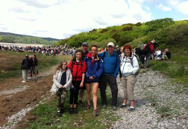
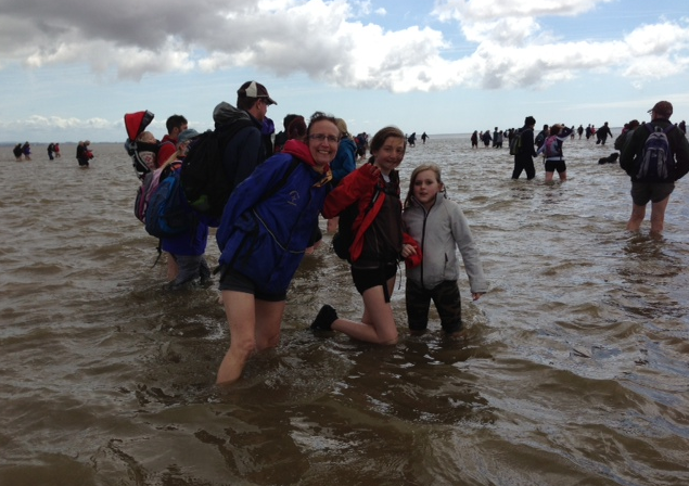
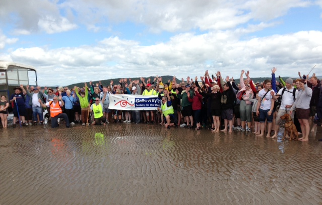
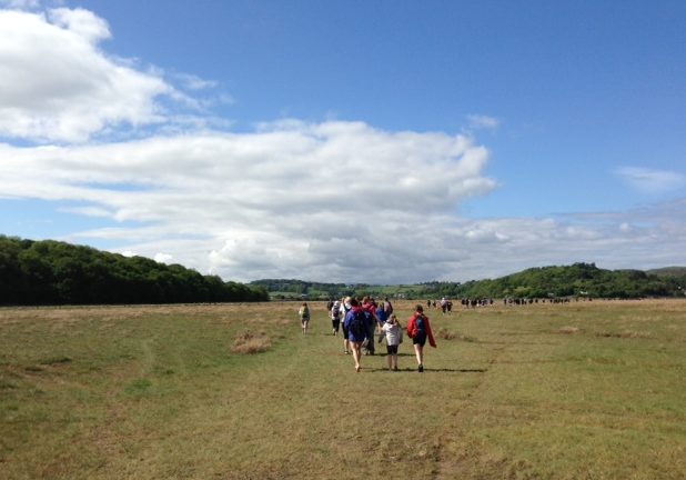
I did this 50-mile race in 2012 in 11 hours with quite a bit of reccying (see June 2012 post) and further reccying this year – so this post is mainly photos and stuff from my new ViewRanger tracking app on my i-phone.

Image
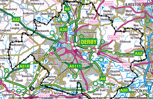
The Start is at Breaston (far right, under black trace) and the route goes clockwise beginning with 15 miles on the canal tow-path. It’s so long that on the laminated safety card you get at the Start, there’s numbers for A&E in 3 different cities!!

It’s a very friendly race and you choose your own start time between 6 and 8am, with relay runners starting at 9am. CP1 (10.5 miles) is the dog-leg upto Chellaston and I got there in 1hr 34 for jelly babies and water. The canal is lovely at that time of morning and I saw 2 herons and other birds. Unfortunately I forgot you needed to cross to the north bank a-bridge-before leaving the canal as the final bridge is railway-only so I needed to back-track 300m! End of the flat….

Image

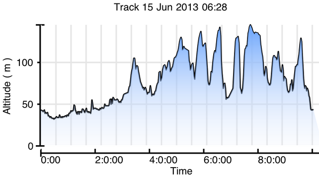
Despite the gentle start, there are 2916 ft of ascent on this run – the dreaded steps of Duffield are the vertical line at about 7 hours

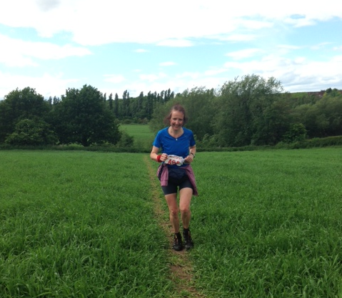
Coming into Findern I was met by a man on a bike in a fluorescent jacket who was showing us how to get through a housing estate into a concealed jitty leading into the fields. From here to CP2 at Littleover is tough to navigate and to run as the grass is knee high and there are no paths.

Got to CP (18.5 miles) in just over 3 hours and texted home that I was ahead of schedule as I had a rendez-vous with my flask and family at CP3!

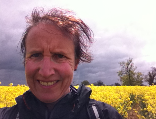
Leg 3 is the worse to navigate but there were written instructions available at each CP and I made sure I picked up a set in Littleover as there were some new directions about avoiding an electric fence in Dalbury. I’d reccy’d this section again in May and took a photo of the oil-seed rape – which by race day was head high!!

Image

Got to CP4 (28.5 miles) Bluebell Inn at Kirk Langley at 11:35 and was met by Dave and Zoe, with coffee but sadly lunch was still in the fridge at home. Dave was dispatched into the pub to buy crisps and peanuts and the man on the bike from Findern gave me a gel. (There was plenty of food at each CP but my milk and yeast intolerance excludes most of it.)

By now I was 30 mins ahead of my 10h 45 schedule and was beginning to think it would be good to come in under 10. There were 21 miles to go, and 4h 30 to do them in so it seemed possible. There were some heavy showers on the way to CP4 at Duffield and I got there at about 1:30. Those that wanted to left a box at the Start to be taken to this CP so I got mine, with food, water and the final stage map.

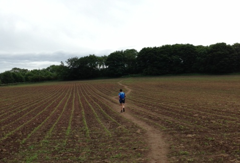
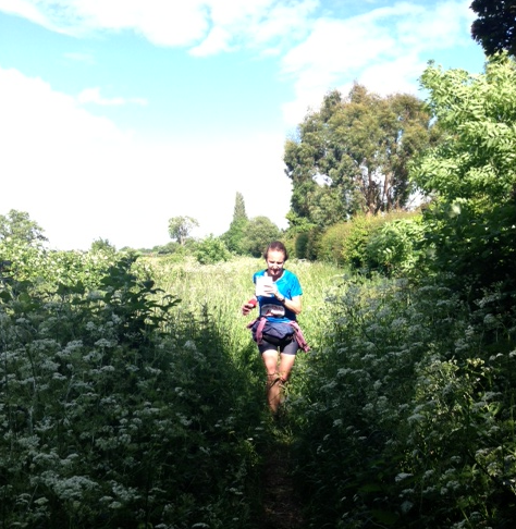
I met Dave at Morley so there are a lot of photos of the last 10 miles….

Image

Image

Dave says this video approaching Dale Abbey shows determination – which is another way of saying I look knackered!

Here’s another one but, beware of horizon shift…

Our stop at CP4 Carpenter’s Arms in Dale Abbey was quite short as I needed to do the last leg (5.25 miles) in under an hour to get a time of less than 10 hours. It’s a nice last leg though, and the route finding isn’t too taxing.

Image

Got a bit of a second wind with Dave setting the pace and soon arrived at the Finish in the car park opposite the Navigation Inn. Was met with a great welcome and camping chair and presented with a mug and the plaque for 1st lady.

Image

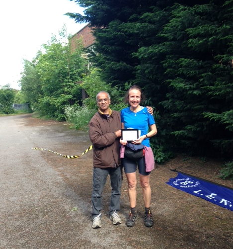
You also get a soup voucher for the Navigation Inn so it was nice to chat to other runners and I’m sure beer is a great isotonic fluid replacement!

Read Full Post »

Morecambe Bay Walk

Although this wasn’t a race, I thought I’d write it up as walking across quicksand for 9 miles still has a definite head-banging quality to it! We registered to do the walk as part of a sponsored event with the Queen’s Appointed Guide to the Sands, Mr Cedric Robinson MBE, to be sure of survival!

It’s not a circular walk so you need to arrange transport to get you back to your car at the end. The train, with the 1857 viaduct across the estuary, is a popular option (see photo), but we lined my dad up to give us a lift.

Image

We arrived at Arnside at noon to find it swamped with walkers, mainly queueing to use what toilet facilities the small village had to offer! We chose a nice bakery with coffee-to-go. I registered us and gave in our cheque to Galloway’s Society for the Blind and then, at 12:30, we were off.

lunch at Blackstone Point

There were over 200 of us and the pace was quite slow as we did the first couple of miles down the coast and through a wood. We had a quick lunch stop on the beach at Blackstone Point (photo above), then headed out across the sands proper. Here the pace quickened as we no longer had to follow the people immediately in front.


You could see the 2 rectangular blocks of the 1983 Heysham nuclear power station on the horizon shimmering in the (?!)heat haze (photo above). Although it was a sunny day with not much wind, I needed my waterproof top all the way, especially as I was wearing shorts. Some people took their shoes off for the sandy part of the walk and this was just about OK as sometimes it was hard sand and sometimes muddy. In some places we were wading in water well above the knees so that was another consideration!

We could see a large vehicle in the middle distance and the Galloway’s Guides seemed to be taking us towards it. This was where Cedric was meeting us to see us safely across the Kent Channel (outlet of the Rivers Kent and Gilpin). We’d had to check the Galloway’s facebook page on Friday to see the latest info for the crossing and were relieved to find that it had been safely marked! This was by laurel branches pushed into the sand that were visible for quite a distance and stayed put for about 3 weeks.

At about 3pm we got to the edge of the Kent Channel and the guides lined us up along one side so we could all cross together rather than in sequence. This was the highlight of the walk for the girls as it looked quite deep and fast!! The whistle blew and we were off. There were  screams as there were a few branches being swept down in the water – sharks!! –  and were where careful that everyone’s mobile was in the highest and driest pocket possible!Image

On the other side we met the huge tractor and grouped up for a photo (you can see us on the right)…

Image

After that we continued south for at least a mile before turning right and back towards the finish at Kents Bank Railway Station. So the Kent Channel on the GPS map is now actually further to the east and is where the GPS trace (red) intercepts the line of pink dots.

Image

We crossed a few other smaller channels before getting to the salt-marshy area next to Humphrey Head. This was grassy and pretty but quite smelly due to the sheep and we put our shoes back on here!!

Image

The last part of the walk had been quite long and tough after the excitement of crossing the Kent Channel and we were glad to get to the railway station and comfort of the car! We finished at 4:45 exactly as predicted, which is amazing with that many people. It had been a really good day and one of the strangest walks I’ve due to the fact that most of it was below sea level…

Image

Read Full Post »

Better Orienteering

Get Better at orienteering Learn orienteering skills techniques Bättre orientering Färdighet Kompetens orientering Parempaa Suunnistusta Taitotaulukko taitojaimprove habilidades de orientación compétences d’orientation Introduction to orienteering Beginner, Newcomer How to orienteer, Basic navigation to Advanced skills

What Cathy Read Next...

For book lovers everywhere

Richard Parkin

welcome to the world of author Richard Parkin

Two feet & two wheels

Wandering but not lost!

The Brockbank Family of Hawkshead

Exploring Brockbank family history in Cumbria

Graham and Val go Coast to Coast

Seattle to Boston - this time, it's personal.

Fight the Good Fight

Voices of faith From the First and second world wars

Sal's Mapping Blog

Making Urban Orienteering Maps for Derwent Valley Orienteers

The Armers of Lancashire

Exploring the Armer family tree

God knows what...

An irreverent look through the worlds of religion, anthropology, psychology and skepticism

ultramadness

follow our adventures in ultrarunning!

Streets Have No Name

A Blog for All and None

Zoë

music / films / literature / life in general

Relentless Tenacity

Preparing for the journey

leg it

Preparing for the journey

Ultra Runner Girl

Writing about running, war zones, and everything in between

Sal's Ultra Blog

Preparing for the journey