Although this wasn’t a race, I thought I’d write it up as walking across quicksand for 9 miles still has a definite head-banging quality to it! We registered to do the walk as part of a sponsored event with the Queen’s Appointed Guide to the Sands, Mr Cedric Robinson MBE, to be sure of survival!
It’s not a circular walk so you need to arrange transport to get you back to your car at the end. The train, with the 1857 viaduct across the estuary, is a popular option (see photo), but we lined my dad up to give us a lift.

We arrived at Arnside at noon to find it swamped with walkers, mainly queueing to use what toilet facilities the small village had to offer! We chose a nice bakery with coffee-to-go. I registered us and gave in our cheque to Galloway’s Society for the Blind and then, at 12:30, we were off.
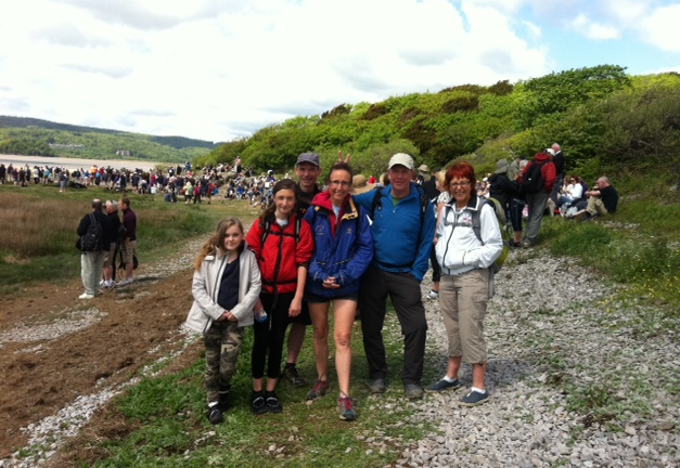
There were over 200 of us and the pace was quite slow as we did the first couple of miles down the coast and through a wood. We had a quick lunch stop on the beach at Blackstone Point (photo above), then headed out across the sands proper. Here the pace quickened as we no longer had to follow the people immediately in front.
You could see the 2 rectangular blocks of the 1983 Heysham nuclear power station on the horizon shimmering in the (?!)heat haze (photo above). Although it was a sunny day with not much wind, I needed my waterproof top all the way, especially as I was wearing shorts. Some people took their shoes off for the sandy part of the walk and this was just about OK as sometimes it was hard sand and sometimes muddy. In some places we were wading in water well above the knees so that was another consideration!
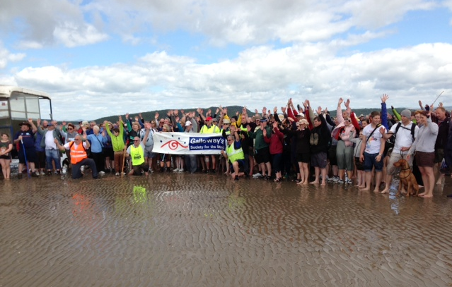
We could see a large vehicle in the middle distance and the Galloway’s Guides seemed to be taking us towards it. This was where Cedric was meeting us to see us safely across the Kent Channel (outlet of the Rivers Kent and Gilpin). We’d had to check the Galloway’s facebook page on Friday to see the latest info for the crossing and were relieved to find that it had been safely marked! This was by laurel branches pushed into the sand that were visible for quite a distance and stayed put for about 3 weeks.
At about 3pm we got to the edge of the Kent Channel and the guides lined us up along one side so we could all cross together rather than in sequence. This was the highlight of the walk for the girls as it looked quite deep and fast!! The whistle blew and we were off. There were screams as there were a few branches being swept down in the water – sharks!! – and were where careful that everyone’s mobile was in the highest and driest pocket possible!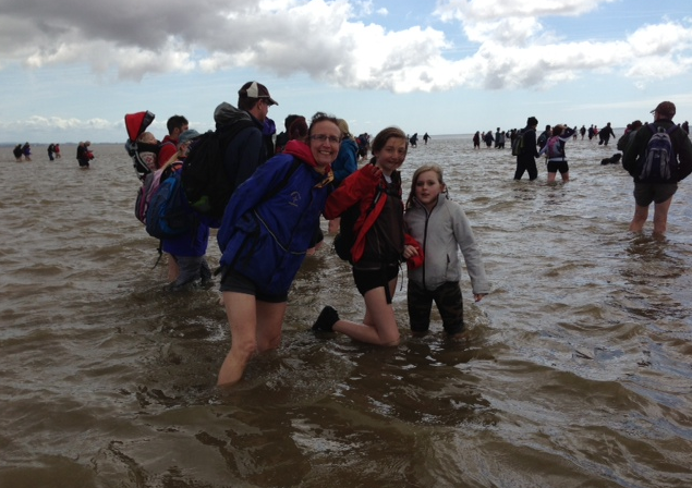
On the other side we met the huge tractor and grouped up for a photo (you can see us on the right)…
After that we continued south for at least a mile before turning right and back towards the finish at Kents Bank Railway Station. So the Kent Channel on the GPS map is now actually further to the east and is where the GPS trace (red) intercepts the line of pink dots.

We crossed a few other smaller channels before getting to the salt-marshy area next to Humphrey Head. This was grassy and pretty but quite smelly due to the sheep and we put our shoes back on here!!
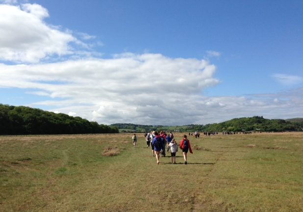
The last part of the walk had been quite long and tough after the excitement of crossing the Kent Channel and we were glad to get to the railway station and comfort of the car! We finished at 4:45 exactly as predicted, which is amazing with that many people. It had been a really good day and one of the strangest walks I’ve due to the fact that most of it was below sea level…


hey great blog sal, what a crackin day out russ and myself were the last to finish at 5.15 a deliberate ploy to make sure everyboby got back- (if yer believe that you’ll believe owt) .no we found the start and finish tough going, for russ especially as he’s partially sighted,but with the kind help of back marker stuart we made it safely, then as luck as it as it some friends of ours keith and cath run the pheasant pub about a mile away in allinthwaite,where the shandy went down like “rabbit gravy” a grand pint to round off a grand day-cheers sal. – rog.