Feeds:
Posts
Comments

What is the Bob Graham Round?

(I didn’t have the blog when I did this 24 hour challenge in 1999, but I thought it would be a good additional post!) The route was first done in 1932 by (yes, you’ve guessed it, Bob Graham) and involves 42 Lake District peaks, 72 miles and 26,000 feet of ascent in under 24 hours. If you think about it, this means an average speed of just over three miles an hour, so you tend to walk the uphills and run the downs and the flats. It wasn’t repeated until 1960, but since then over 1700 people have done it.

Preparation

Over the previous year I had built up to running/walking 45 miles (i.e. being on my feet for 10-15 hours) and had reccied all of the route at least twice, using my Dad’s house in Windermere as a base — and calling on his babysitting abilities while Dave ferried me to distant start points and accompanied me on runs (or more often went gear shopping in Keswick!).

Organisation

The route is divided into five sections where it crosses roads (HonisterPass, Wasdale Head, Dunmail Raise and Threlkeld) and at each of these points a different pair of ‘pacers’ take over to carry your food, fine tune the navigation and record your time on each summit. I’m lucky that my brother — who has done the BG in both summer and winter (fool) — could organise much of this, although John Duckworth and some other Derbyshire folks accompanied me on my first attempt and Dave Clough saw me briefly (!) on the second one.

You can run either clockwise or anticlockwise and it’s best to set your start time so that you do the grassy Helvellyn ridge in the dark — this means a morning start going anticlockwise or an evening one if going clockwise, although having said that, a lot of people start at midnight and do Skiddaw in the dark.


Attempt 1: Clockwise, May 28th

I shouldn’t really have started this as the weather was so foul and, sure enough, we lost a lot of time at night to atrocious visibility. I didn’t have the energy to start running again once the dawn broke, but I carried on a bit, hoping for a second wind. It never came, so we packed in at Rossett Pike, about half way round, and took the low route on to Wasdale. I don’t know if I’d have got round then, even in good weather, as I was recovering from a cold, had only trained to 30 miles, and felt pretty bad for missing a night’s sleep so early on in the run … a new strategy was required — an anticlockwise attempt.

Attempt 2: Anticlockwise, July 10th

A walking holiday in Ireland plus doing the Saunders Lakeland Mountain Marathon with Dave got me in good shape for this. You have to do a write up for your run to count officially, so here it is.

I opened the curtains on Saturday morning gutted to see mist of the consistency that had thwarted my previous BG attempt six weeks ago, and even considered postponing things on the drive to Keswick. Good thing husband/road manager Dave talked me out of it! Joined pacers Tony Walker and George Robertson at the Moot Hall and set off at 7.30 Imagethrough the mizzle to Low High Snab, reaching the summit of Robinson in 90 mins. The mist was thinner on the tops, so navigation wasn’t a problem (yet!). One of the main roles for pacers on this section is to slow you down, but I’m glad Tony and George didn’t do this.

At Honister, Mark Flemming and dog Maggie took over. After Mark’s canny route off Great Gable, where I was thoroughly disoriented, we were on schedule to Pillar but started looking for Steeple too early — before hitting the wall on Scoat Fell — so lost 15 mins, but apart from that, Maggie had a pretty good nose for the path when she wasn’t too busy chasing her tail! Was cheered to see Hilda on her clockwise BG at Steeple and still on schedule. Good scree run off Yewbarrow — better than stumbling through bracken covered boulder fields, as on my previous recce.

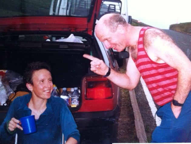
At Wasdale was met by Dave Clough from our orienteering club who’d walked over from Honister having just missed me. Had some of Kate’s chicken stew and a Dioralyte to rehydrate, plus mandatory tea and Isostar. Seeing Fred Rogerson there made the BG attempt somehow seem more real.

Then new pacers Brian and Susan Clough for the Big Bad Central Section. On the way up Sea Fell took an impromptu decision to descend via Lord’s Rake rather than Fox’s Tarn and this saved a lot of time as it was only 31 mins summit-to-summit. Saw some of the Wasdale racers on Sea Fell Pike — great atmosphere up there; the pacers seem to know everyone we pass, like it’s their local high street. Brian and Susan had some canny routes and a seemingly endless supply of jelly babies, which saw me through my only bad patch. I remember saying to Brian when we were descending Bowfell that Rossett looked like the Eiger, but we were there in a jiffy, having coffee and Battenburg with Munro Bagging chums Sue, John and Martin. They said they’d seen me looking worse, but only after a night in the pub! The mist had cleared now and John Cann joined us to Dunmail, where he arrived in his white T-shirt, looking more like a Persil advert than a fell runner!Image

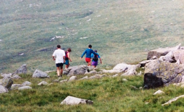
The crowd put on a great welcome and I had some more stew and Dioralyte by the dual carriageway. The last three sections had taken 12 hours 50 mins, exactly to schedule.

ImageIt was a good feeling setting off up Raise Beck with BG guru Eric Draper and husband Dave, knowing that I had 11 hours to get back to Keswick and plenty of daylight to get off Fairfield. Eric found the gully down and we were soon zigzagging up Dollywaggon. Helvellyn was reached, 30 minutes up on the schedule. The wind was starting to pick up now but there was no mist and the grassy whalebacks of the Dodds were soon traversed. However, the 30 minutes were soon lost in the farmland at the bottom of Clough Head where we plodded through endless tussock of reeds with a few stone walls for good measure. Boy, was I relieved when I heard Eric say he was on the road.

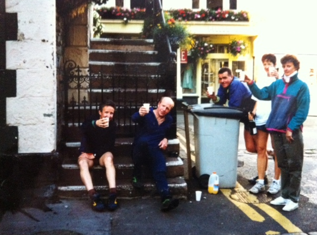
Met brother and BG veteran John Brockbank at Threlkeld where I scoffed some egg butties and set off up Halls Fell Ridge, Eric continuing on this section too. Torches off at the top and jogged down Mungrisdale Common to a technicolour dawn (which, having caught on camera, John proceeded to fall into a bog and submerge said camera), Imageand ice-cold Caldew and that endless fence up Calva. I was slowing on this last section, and it was a good job it wasn’t any longer or I wouldn’t have made it. On the top of Skiddaw we met Dave in an icy wind and jogged down to crystal clear views of the whole of the Lake District rippling out in front of us. Met Caroline and Kate (Eric and John’s partners) on the way into Keswick and arrived — incredibly happy — at the Moot Hall at 7.03 where there were hugs and Bucks Fizz.Image

Image
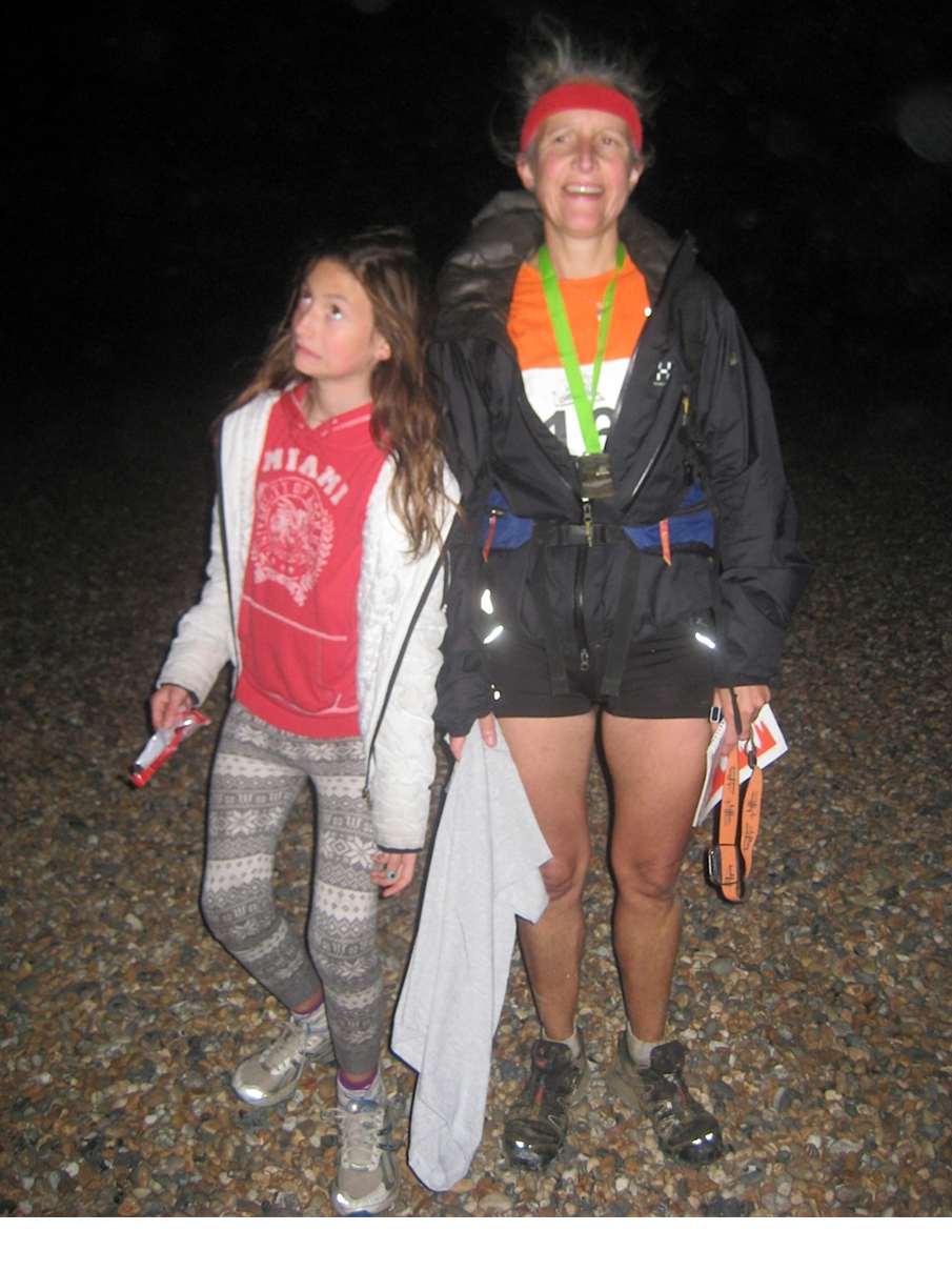
Thanks go to all the pacers for their excellent company (and those that paced six weeks previously); to training partners in Derbyshire and the Lakes; to John for inspiring me, showing me the routes and rallying the support for both attempts; to Dave for believing that I could do it, not letting me give up when winter training was getting me down (this tended to involve taking me to the pub) and miles of driving over Lakeland passes; and to my Dad and Dave’s family who spent many a weekend looking after Zoe while “Mummy ran up the mountains”.

chips

The night before and chips for all the family – honest!!

After over a year of anticipation, the day finally dawned – although I should say the alarm went off at 4:30am, 2 hours before dawn! Registration at the TA Centre in Blackheath closed at 5:30 and I had a DIY breakfast of potato farls in the hotel room (ever smuggled a toaster into a Hilton before?).

Dave drove me there and waited to see me start. There was quite a buzz about the place and good facilities. They do a bag transfer to the Finish, but we didn’t use it. Dave picked up his own Route Book, which was handier than the photocopies I’d made. Road support is quite tricky when you don’t know the area and have children who won’t navigate for you!

I later learnt that there were 196 of us at the Start and I soon found myself at the back of the leading pack of 5, bearing left down hill across the grass. The bit through Lewisham and Catford is fiddly – through a mixture of back streets and urban parks. A torch was necessary for the first half hour or so.

start

6am start at Blackheath TA Centre

There’s an unlikely bit where you go through a retail park after Catford Station, then you run alongside the Pool River to the first hill at Bellingham. People were starting to overtake me here and I made an error coming out of a wood on the golf course which meant I ran extra distance round a field.

I got to Bromley Station at about 6:55, you then stay on a B road for 5 km to the first checkpoint at Keston. I arrived there at 7:38, 3 mins behind my 12hr schedule time but still pleased. There was plenty of water so I filled my empty bottle (hadn’t carried any for the first 10 miles to save weight) but only bananas so I had some food I’d carried.

Suddenly the route is in the countryside and the navigation is very tricky. I lead whatever pack I was now with to Furze Bottom, from which you can see a column of runners walking up towards Biggin Hill RAF Station.

After that it’s up the nose of Biggin Hill itself and over some flinty ploughed field to Tatsfield, where there’s a nice village green for supporters to hang out – but mine were still emerging from the hotel!

A kilometre later was the first of the day’s permitted detours across private land. These two places are the only bits where the route is signed. A stile had apparently been put up across a barbed wire fence but had been removed so we climbed over some wobbly tree branches.

limpsfield chart

9:20am – up the hill to Limpsfield Chart at about 18 miles

After that you cross a bridge over the M25 just west of Clacket Wood Services and climb up to another nice village, Limpsfield Chart. Dave and the girls met me here at about 9:30. Had some food and water but didn’t hang around for the coffee. This race is so long that every minute counts! The organisers even warn you not to start walking just coming up to any stiles!!

Had a navigational wobble and went wrong way to Checkpoint 2 but only minimal extra distance but 5 mins hesitation error. Got to checkpoint at 9:40, 25 mins behind 12 hour schedule, which was worrying but I was running well and not feeling too tired. They had the legendary cold roast potatoes here and they went down very well!

3km along farm tracks then you cross Edenbridge Golf Course then some paths on the Eden Valley Walk where you need a compass. Dave met me just east of Dormansland and did 4 miles with me, which he then had to reverse to get back to the car! The route is hilly but very pretty as you approach Checkpoint 3 at 28 miles. Got there at 11:35, again 25 mins behind schedule, but no increase in slippage time which was good.

Coming into Ashurst Wood, I’d got lost on my reckie and still did it sub-optimally – but at least I didn’t have to resort to navigating with my i-phone! You then go east round Weir Wood Reservoir on more farm tracks and up into Lavender Platt wood where there’s a car park where spectators can meet you. Mine missed me, but everyone else’s supporters give you a good cheer! Then it was a nice run into Checkpoint 4 at Horsted Keynes past some very secluded farms and forestry.

Picked up a phone call while having some potatoes and biscuits at the checkpoint and met Dave 2km after. Then saw him again at Freshfield before he went to park at Chailey Common and came out with our youngest to run with me while the eldest got the coffee ready! (Wow, did I really run 34 miles before I got my coffee??)

Exiting Pound Common I went the wrong side of a farmhouse and had to run 3 sides of a square and cross 2 barbed wire fences in thorns. After this I can’t remember much until Checkpoint 5 at Chiltington, 48 miles, where I arrived at exactly 4pm.

black cap better

Walking up Black Cap with the family

That the 10 mile section to the Finish took 3 hours 7 mins shows how slowly I was going, but I was still running. There’s about 1000 ft of climb over the South Downs and Dave and the girls did the main ascent up Black Cap with me. On this section you are on walkers’ footpaths so the navigation is easy.

You take a bridge over the A27 at Falmer and go parallel with the very fast Falmer Road but in the fields, just on the verge for about 300m. Then you run along the seemingly endless north edge of Woodingdean and turn south onto Brighton Race Course which is very nice running with great views. It was dark by now and I had a black cagoule on so although Dave had reversed the route from the Finish, he missed me and Zoe had to phone him from the Finish.

It’s bizarre but great running down into Brighton on a Sunday night and then onto the beach. It’s a shame I didn’t make it in the 13 hour cut off, but the Finish was still there and I got my medal and T-shirt but was disappointed not to be listed in the Results as just 88 of the 196 starters ran under the time limit.

We’d arranged to have tea and a shower at a friend’s house in Saltdean, which was lovely. She had put me in touch with a friend who’d done it 2 years ago and who told me to reckie – which was excellent advice, without which I’m sure I wouldn’t have finished.

We got back home to Derbyshire just before 1am and I had the next day off work but was in for a 12 hour shift on the Tuesday, still stiff! Much better on Wed. lots of good memories – and better still, Dave wants to do it next year!

brighton beach

On Brighton beach with Sarah 🙂

Friday

The London to Brighton is a 56 mile largely off-road race and the main focus of my training this year.

Three and a half weeks to race day and we finally got our map books in the post. I’d heard this is what normally happens, so had put out email tentacles and was sent a write-up by a friend of a friend who did the race in 2010. Because he’d seen nobody between 25 and 40 miles, and also my experience of getting lost in the Long Eaton race, I thought I’d better recce!

Our youngest child going to Guide camp offered a perfect opportunity a fortnight before the race, so I booked my train tickets, planning to walk the whole thing over 3 days. Even tho the 1:25000 OS maps in the route book looked nice and clear, I didn’t want to leave anything to chance.

In London, I caught the DLR to Lewisham, nearest station to the Start. This is in a TA Centre and I got quizzed by the security man as to why I’d taken a photo of the sign on the gate! The streets of Lewisham, Catford and then Bromley are quite fiddly and it’s easy to make what orienteers call a ‘parallel error’ where you mistake one junction for another and everything goes pear-shaped!

The route followed a couple of urban nature reserves alongside the Ravensbourne and PoolRivers. It would still be dark while running this section on race day so it was a good confidence boost!

After Catford Station there was an unlikely looking exit from a retail park and I annotated my book ‘Go past Halfords and Wickes’. Then at Bell Green I somehow ended up marshalling traffic as a lorry had to reverse to avoid a low railway bridge!

I had my packed lunch at Beckenham Place Golf Club where I saw a fox and several squirrels. After Bromley and Hayes you get to Keston where I had a coffee in the pub and found the location of Checkpoint 1 at 10 miles. My friend-of-a-friend’s write-up said that the 300 year-old Wilberforce seat is here where William Wilberforce proposed to William Pitt that they should introduce a bill to abolish slavery, so I kept an eye open for it. Later I showed my map book to some walkers who told me the location but it was off the 2012 route so I never saw it!

I got quite lost in some orchards shortly after and had to get my i-phone out to navigate, eventually finding the route again but backtracking so I could annotate my book. The mistake cost me 30 mins but better now than race day!

After this there was a climb up to Biggin Hill where the route emerged for 400m onto the A233 at the Air Base. I was lucky to get a look round the very moving RAF Chapel which closed at 4pm.

The next page of map takes you to Tatsfield where there’s a Post Office and store. It’s handy to know where there are shops just in case you need extra food or water (a £10 note is much lighter than a bottle of water you may not need)!

Late Friday afternoon, so somewhere near the M25

I had to detour here round some private land that was only crossable on race day, then it was over the M25 just west of Clacket Wood Services. I’d earmarked the pub at Limpsfield Chart as the place to knock off for the day and call a taxi and got there at 6:30 after 8 hours of walking and 18 miles into the route.

Saturday

Having stayed at a friend’s house in Caterham, the same taxi picked me up at 8am and dropped me back at Limpsfield Chart. There was a nice descent of the North Downs here and I soon reached Checkpoint 2 on a minor road where spectators were not allowed on race day.

Edenbridge Golf Course was tricky to navigate so I put more biro on my map and searched for somewhere to have coffee. Didn’t find anywhere until Ashurst Wood at 2pm but the Three Crowns was worth the wait. A sign told me that when it opened in 1743 the rent was 12p a year, now it’s 12p a minute!

There was a nice section past Weir Wood Reservoir but this day was 10 hours and it was still two and a half pages until I could knock off. Had another coffee in a pub at Horsted Keynes, location of Checkpoint 4 and generally pretty village.

I was getting quite tired of the constant faff of navigating and today was a bit boring compared with the excitement of London yesterday. Got to the Sloop Inn at Freshfield Bridges just after 6 and borrowed the pub phone as I had no signal. Took my pint outside to wait for the taxi to my B&B. I’d completed 25 miles in 10 hours and was now 43 miles into the race!

Sunday

Yet another taxi brought me back for the last leg which started with a 3 sides of a square detour but at least it went past a nice campsite with some toilets. Chailey Common was very pretty and I could hear the tannoy from Plumpton Race Course for several miles.

It was here near Checkpoint 5 (again no spectator access) that I got the first welcome views of Black Cap where the route crosses the South Downs. The classic road race crossed the Downs via Ditchling Beacon, 3 miles to the west but hasn’t been run since 2005.

Here I saw another pair of runners with the telltale A5 spiral-bound route book and we had a quick chat and wished each other good luck for on the day. I thought I wouldn’t see him on the big day but I did!

There was a large ploughed field crossable only on race day to go round, then it was up Black Cap which was great after the monotony of the middle third of the route. It got cold though as you picked up the breeze from the Channel. There’s some straightforward easy running past Falmer and Woodingdean and then the stunning descent into Brighton crossing the hill-top racecourse and following a big spur to East Brighton Golf Club. Then its just 400m to the beach and the Finish at Blackcap Volks Railway Station.

Me at the pier

The last 16 miles had taken 6 hours bringing the total walking time to 24 hours, minus an hour over the 3 days for food stops and probably 2 hours for navigational errors = 21 hours. As a result of the recce I upped my 11hr schedule to 12hrs and wished it was 10 years ago and I’d entered the road race! Never mind – I felt confident of not getting majorly lost on the day as I fought the seagulls off my well-earned fish and chips at a beach-side café.

In 2010 the Derby Nomad Ramblers group decided to celebrate their 75th anniversary by planning a long-distance route around Derby on existing footpaths. The route is 50 miles and is waymarked with yellow and black markers.

It formed the basis for Long Eaton Running Club’s 52 mile ultra race, which I completed in June – some of my orienteering club friends were doing the Footpath Relay on the same wet and windy Saturday! It’s only the 2nd year they’ve run the race and this year there were 25 finishers plus a handful of teams running it as a 6 leg relay – sadly not enough people on the course to reliably follow!!

The route info was supplied as 50 strip photos from Google Earth and it took me 4 hours to stick these together on A1 card and transfer the route onto 8 bits of A4 1:2500! A marathon of Pritt Stick and highlighter pens!

The Start was in Breaston near Long Eaton, from where it’s about 5 miles down to the Trent and Mersey Canal at Shardlow. I reccy-ed this bit and we had a nice afternoon out in Shradlow looking at the tiny Heritage Centre and the canal-side pubs.

From there the route follows the canal to Findern, then up to Littleover and 2 ½ miles along the greenway towards Etwall. The next section (Dalbury to Kirk Langley) I decided to reccy and it’s a good thing I did as the vegetation was very high, hiding many of the way markers. In fact, I caved in and decided to take 6 sides of impenetrable route description with me on the real thing!

After that, it was local territory from Kedleston to Duffield and Drum Hill. By Stanley Dale Abbey and Risley I figured I’d be walking anyway so navigating wouldn’t slow me down.

On the day…

The 7am starters in the Long Eaton Ultra. I’m in orange

We had all chosen start times between 6am and 7:30. I opted for 7 with 5 other runners so we set off from Breaston’s Navigation Inn in fine weather. The first checkpoint (12 miles) was a mile dogleg away from the canal at Chellaston and I got there in 1hr 52 having a welcome drink and some Jelly Babies. Checkpoint 2 is the Hollybrook Inn at Littleover and I got there at 10:25am. I ran with a Japanese runner who’d come up from London. He’d started at 6am so had lost a lot of time navigating. We walked most of the greenway to Etwall as it was raining and we were tired after 22 miles but then I got a 2nd wind and went ahead. I later heard he retired at Duffield.

The next section via Dalbury was fiddly and slow (e.g. crossing wheat fields that hadn’t been trampled even tho’ a public footpath, hidden stiles) – but at least it stopped raining! Checkpoint 3 was the Bluebell Inn at Kirk Langley where Dave and Sarah were meeting me with coffee so I had a welcome sit down and a good feed! I’m lactose intolerant so I can’t eat any of the lovely cake they had at the checkpoints.

Dave and Sarah ran with me in Quarndon then Dave met up with me again in Dale Abbey. I should have reccy-ed this bit as I missed the start of the path from the A6096 and ended up having to wade through chest high nettles and brambles after running along 3 sides of a field to join it. Lost me 15 mins! Dave found me soon after and we ran together to Checkpoint 5 the Carpenter’s Arms at Dale then Dave continued as navigator all the rest of the way, encouraging me to keep running up the hills.

52 miles later!

The last bit was lovely – a golf course north of Risley descending at the perfect gradient for tired legs, then what felt like a massive climb up the bridge over the A52, 4 more fields then home! I was pleased with my time of 11 hours 3 mins, 25 mins behind the 1st lady. It was a really friendly race, the best £17 I’ve spent in a long time!

The problems with navigating have made me resolved to reccy the London to Brighton Race at the end of September – it’s 57 miles and I don’t want to do any unnecessary ones! Even tho’ there are about 120 runners, I’ve heard it’s quite likely not to see anyone for 15 miles!


Happy to have finished 2nd woman in the Long Eaton Ultra

I found out about this race when innocently reading someone’s blog and thought it would be a good try-out for the London to Brighton race which I’ve wanted to do for a few years now. That race is hilly and has aggressive time-outs whereas this one is literally along 2 canal tow-paths for all but a mile of its 56! It’s also £50 cheaper to enter!!!

The race is in April and my training was getting ready for the Wilmot Wander round Derby which is 32 miles and very hilly – very muddy too as it’s always in January! I did the race in 6 h 15 and did it again in training 3 weeks later, managing to count 80 stiles along the route. Well, I thought, if its half a minute lost per stile, I could do that 40 mins faster!

Husband Dave, daughter Sarah and I went up to Glasgow by train and got a good deal at the Hilton which we managed to seriously negate by having a blow-out 3-course room-service meal. The race started at 9am at RuchilPark in Glasgow and we dropped off a bag each for Checkpoint 2 and another one for Edinburgh. The route followed a branch of the canal north for a mile before joining the main Forth-Clyde Canal. The instruction was to turn right here otherwise we would end up at Clydebank on the west coast!

Everyone must have been saving themselves as I was 2nd for the first 2 miles of the race, and about 10th by the first checkpoint at Auchinstarry. This was 13 miles in and I got there in 2 hours, refilled my water bottle and had a Bakewell tart from Dave and Sarah who’d got there by train. From then on, they managed to get lifts from 2 different runners’ wives – probably because Dave was sporting some handy OS maps and Sarah – aged 9 – looked fed up!

The route was very pretty, there are lots of Roman ruins and alleged bits of the Antonine Wall and there’s been some millennial regeneration of the canals, which had slipped out of use since the 1930s. The main focus of this was the opening in 2002 of the Falkirk Wheel which lifts canal boats 40 metres from the Forth-ClydeCanal to the UnionCanal – but only when there’s a boat coming in the other direction to counterbalance it!

The Falkirk Wheel at 22 miles – the world’s only rotating boat lift, replaces a series of 11 locks and the only climb in the whole 56 miles!

The second checkpoint was at the Wheel, 22 miles into the race, and I got there at about 12:30. There was a nice atmosphere there and some of the visitor centre crowds had come to spectate while runners’ partners enjoyed a bit of tourism! From here on I carried a bladder as it was getting hot and we were well into the race.

We had to detour from the canal here as a tunnel was in need of repair so there was a marked route up through Falkirk for a mile. The next leg to Linlithgow was 11.5 miles and was the low point of the race as the end wasn’t yet in sight but I kept telling myself I could walk after Checkpoint 3. I got there at 14:50, ate and refilled my bladder.

The next section to Broxburn was 8 miles and the canal did a big S bend so I could expose my left side to the sun for the first time in the day! I got a bit of a second wind but was still moving slowly, needing to walk some bits. At Broxburn, the next leg was only 5 miles and everyone was doing it without rucksack so that was a nice bit of relief.

We met our friend Chris here with her car so they were able to intercept me at other points and Chris and Sarah would wave from bridges while Dave ran with me. He did all of the last 9 miles from Checkpoint 5 at Ratho to Edinburgh Quay. It was interesting to see how the canal crossed the M8 via an aquaduct and gradually the route got more urban as we ran into Edinburgh. Parts of the UnionCanal had been filled in when it fell into disuse in the 1930s but since 19?? It had been restored to its 18?? Glory.

The last 9 miles took me 2 hours and I finished in 11 hours 3 minutes, coming 46th out of 64 and 8th woman. It would be interesting to see if going slower on the first bit would make for a faster overall time – but I think you should always go for it while feeling fresh! Perhaps I’m too impatient for ultra distance running!

POST-SCRIPT: This race was much better for a beginner than the London to Brighton – 5 miles shorter, no climb (literally) and canal tow-path all the way – as the organisers say, ‘If the canal’s not on your right then you’re lost!’ Because you run from west to east all day (and the canal is always south), the right half of your body comes back sun-burnt!!

Next year the race is on Sat 6th April, check out http://www.resoluteevents.co.uk/GEDM.html

Hubris at Abraham’s Valley (Cannock Chase)

(This was written for the DVO Newsletter & I dug it out to psyche for the Midlands Champs 2015 on the same area)

After 21 years of orienteering with AIRE, TVOC and DVO for the last 14, it was a dream come true to win W45L at the British Champs in Cannock! I had quite an early run and the first three controls were OK; I always try to make risk-averse route choices, staying on paths until as close as possible to the control. This suits me as a runner, and I try to maintain constant map contact.

The complex area (Nos 3 to 8) filled me with dread so I identified some catching macro-features like fences and wooded ridges, and was pleased to find from WinSplits that I only lost 30 seconds on No 8.

The rest of the course suited me as it was physical rather than technical, with 2 legs over a km in length. It went fine but I realised I was in oxygen debt at No 10 when for some reason I was expecting white on the map to mean open ground, so I tried harder to concentrate after that!

WinSplits showed that Liz Jackson was ahead of me until No 14 but lost a minute here, a veg boundary between conifers and deciduous. I didn’t feel too bad about coming in ahead of her as mistakes near the end of a course have deprived me of a podium place a couple of times. Apparently it’s called post-crux failure syndrome, and shows the importance of maintaining concentration until the very end!

It was a long wait while the results came in, especially with the likes of Stella Lewsley and Kath Broatch still to run. I was hoping for a top 10 place as I was 6th last year in the New Forest, but was amazed and pleased to be first!

Our team on Sunday looked promising with Michelle and Sue, but I went and blew it on 1st leg loosing a minute following a ditch at about 30 degrees to the correct one. It was wrong in relation to the open area I could see outside the square of forest, but the oxygen debt must have been too much for rationality to get a look in. The rest of the run was fine, and Michelle and Sue both had clean runs pulling ‘DVO Labour’ up to 4th. Uncannily similar to the fate of Gordon Brown!

This is why orienteering is so addictive, one minute you think you’ve cracked it, then you realize there’s always room for improvement!

Better Orienteering

Get Better at orienteering Learn orienteering skills techniques Bättre orientering Färdighet Kompetens orientering Parempaa Suunnistusta Taitotaulukko taitojaimprove habilidades de orientación compétences d’orientation Introduction to orienteering Beginner, Newcomer How to orienteer, Basic navigation to Advanced skills

What Cathy Read Next...

For book lovers everywhere

Richard Parkin

welcome to the world of author Richard Parkin

Two feet & two wheels

Wandering but not lost!

The Brockbank Family of Hawkshead

Exploring Brockbank family history in Cumbria

Graham and Val go Coast to Coast

Seattle to Boston - this time, it's personal.

Fight the Good Fight

Voices of faith From the First and second world wars

Sal's Mapping Blog

Making Urban Orienteering Maps for Derwent Valley Orienteers

The Armers of Lancashire

Exploring the Armer family tree

God knows what...

An irreverent look through the worlds of religion, anthropology, psychology and skepticism

ultramadness

follow our adventures in ultrarunning!

Streets Have No Name

A Blog for All and None

Zoë

music / films / literature / life in general

Relentless Tenacity

Preparing for the journey

leg it

Preparing for the journey

Ultra Runner Girl

Writing about running, war zones, and everything in between

Sal's Ultra Blog

Preparing for the journey